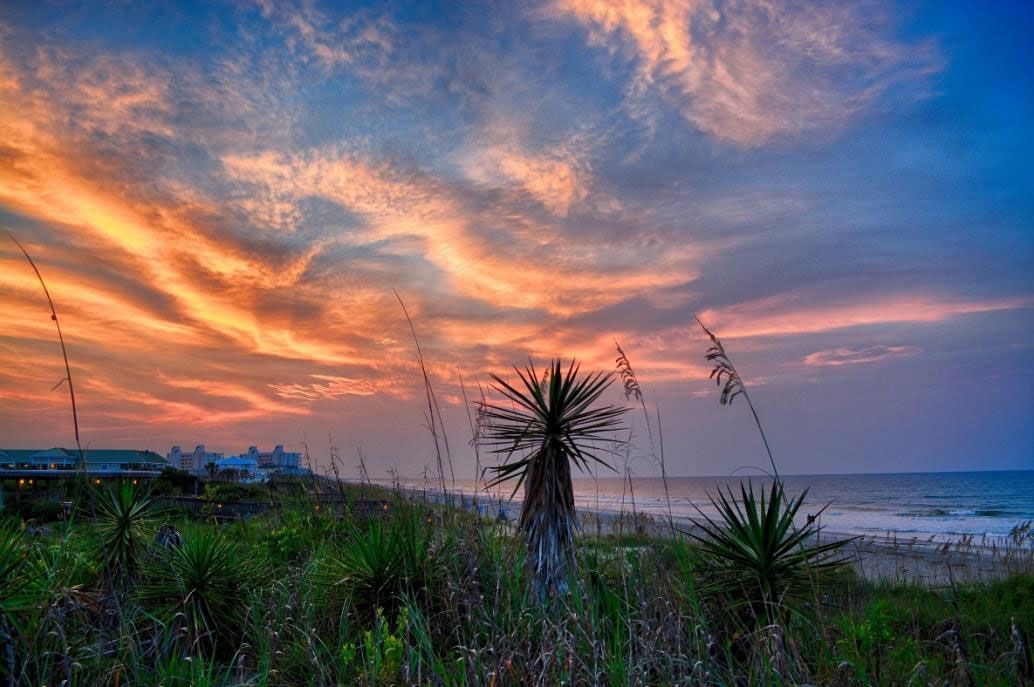
HURRICANES AND THE ISLANDS OFF NORTH CAROLINA
Hurricanes are some of the most interesting yet devastating occurrences in nature. They are like formidable forces that arise in the middle of nowhere and then embark on a journey to destroy everything in their path. These forces have often visited the Coasts of North Carolina and the islands off the coasts.
What Are Hurricanes Anyway?
Hurricanes are tropical cyclones that form over the Atlantic Ocean with a wind speed of at least 74 miles per hour (mph). If the wind speed of a tropical cyclone is less than 39 mph, it will be called a tropical depression, and if the speed is 39 mph and above, but less than 74 mph, it remains a tropical storm until it crosses the 74 mph threshold. How then are these looming forces formed? If you didn’t know, you're about to find out!
Tropical cyclones are formed during the late summer months (June through November and peak between August and October), when the tropical waters are the warmest and evaporate readily. Winds coming from the east cause the waters to evaporate more quickly. The warm moist air is then sucked up and moved high into the earth’s atmosphere where it begins to cool and condense into clouds as large as stormy cumulonimbus clouds. As the warm air continues moving upward, it is converted into the energy that powers the cyclone’s circular winds. The winds then cause the large stormy clouds to cluster and spin continuously around a low-pressure center called the eye. The eye of the hurricane is exceptionally calm—surprising even—and can span 20 to 30 miles. Swirling around the eye of the hurricane is the eye wall. It is formed by stormy clouds tossed around by the fastest hurricane winds. Right outside the eye wall are the Rain Bands. They are curved bands of clouds that can span several miles and they are loaded with sheets of heavy rain and sometimes tornados. As soon as a Hurricane hits land, it runs out of warm air (its fuel) and begins to fizzle out. However, because of its speed and wide radius, it usually causes a lot of damage before it eventually disappears.
Credit: Erich Schlegal Getty Images
You've probably heard of popular hurricanes like Hurricane Fran and Hurricane Hazel, but did you ever wonder how these hurricanes are named? Several years ago, the meteorologists of the United States named the storms after their latitude/longitude origin. As you can imagine, it was cumbersome, difficult to remember and, easily miscommunicated. During World War II (1939-1945), military meteorologists in the Pacific started naming storms with female names, likely after their wives or daughters. It was much easier to recall and more efficient in communication, hence, it was adopted by the National Hurricane Center (NHC) in 1953 for Atlantic Hurricanes. Sometime later, due to rising arguments about gender equality, meteorologists began including male names for the storms. Each year a list of names arranged in alphabetical order is developed. Then, the first tropical storm of the year would be given the first name according to the alphabetical order, and the second would be given the second name and it continues that way till the end of the year. Today, the World Meteorological Organization maintains this list. Some of the names can be repeated after six years, but the names of significant, popular, and severe storms are not reused.
How Are Hurricanes Categorized And Which Ones Are The Most Dangerous?
Hurricanes are generally categorized into five (5) using the Saffir-Simpson Hurricane wind scale. The scale was developed in the early 1970s by an engineer, Herbert Saffir, and a meteorologist, Robert Simpson, to estimate the potential damage a hurricane could cause. The scale is solely based on wind speed and does not account for tornados, rainfall flooding, and storm surges. Category I has a wind speed between 74-95 mph. It is the mildest of the categories and will most likely result in a power outage for many days due to damaged power lines. It can also cause large branches of trees to snap and shallow plants to be uprooted. In 2018, we experienced a hurricane of this category called Hurricane Isaias, here at Topsail Island. We could barely sleep and only kept praying and hoping the cyclone would pass quickly. We certainly don’t want to experience any of the higher categories! Category 11 has a wind speed between 96-110 mph. It can cause roof sliding and damage with numerous roadblocks from uprooted trees. Power outages from damaged electric lines can last for weeks. Categories I and II can cause significant damage but these aren’t even the major hurricanes.
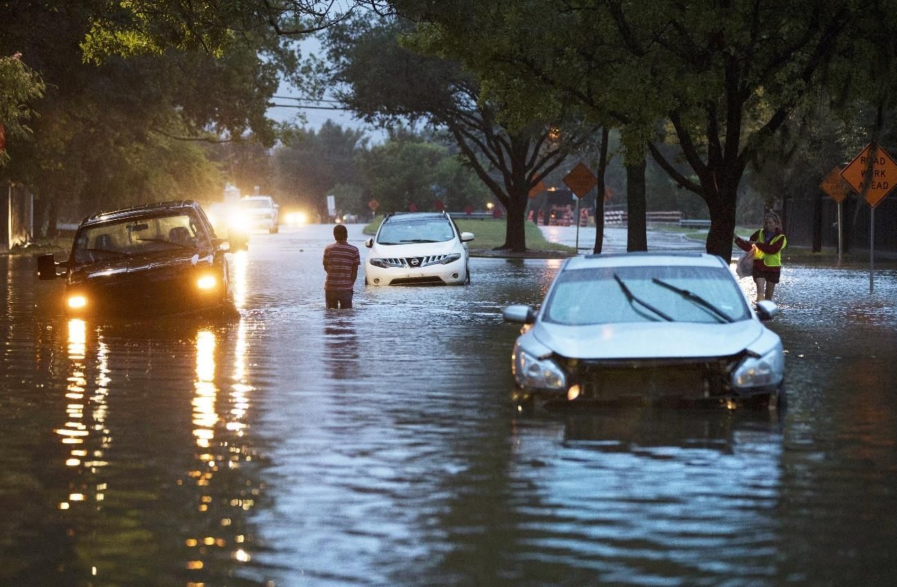
Category III hurricanes and upward are considered to be major hurricanes because they are a lot more devastating. Category III wind speeds are between 111-129 mph. Even well-built and well-framed houses can sustain significant damage from these hurricanes and many large trees can be uprooted completely. Electricity and water outages can last for several weeks after the storm passes. Category IV hurricanes have a wind speed of 130-156 mph. Most of the areas damaged by hurricanes of this category may be uninhabitable for weeks. Category V hurricanes are the most catastrophic. They have a wind speed of 157 mph or more. Damaged areas would likely be uninhabitable for months till interventions and reconstructions are carried out. Hurricanes with the highest wind speeds are quite destructive but the most concerning aspect of a hurricane is the Storm Surge. Storm surges occur when the winds from an approaching hurricane push water toward the shoreline and cause severe flooding. Sometimes they can take water up to 50 feet above sea level and can extend up to a hundred miles.
Have you heard of the Winter Nor’Easters?
Winter Nor'Easters are a kind of storm that can sometimes be more devastating than a hurricane. The winds that form these storms usually come from the Northeast, hence the name. They mostly occur in New Canada and Atlantic Canada but they occur here in North Carolina sometimes. They come frequently in the colder months (September to March) and can cause snow storms, heavy rain with flooding, and beach erosions. If a Nor'Easter is coming your way, prepare several blankets with lots of food and water in reserve.
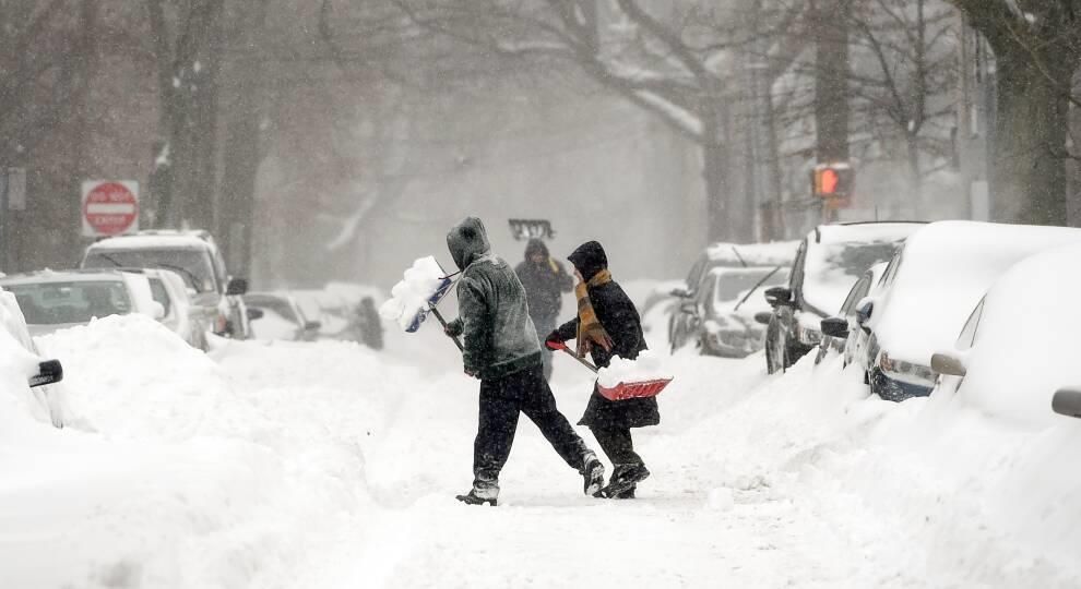
Blizzard caused by a Nor’Easter. Meredith Nierman / WGBH News
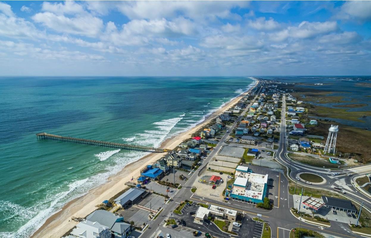
Hurricanes In North Carolina
In the span of 172 years (1851-2022), North Carolina has been affected by three hundred and eighty-seven (387) storms. Three hundred and three (383) of these were non-landfalling storms, while eighty-four (84) were direct landfalling storms. The Carolina Alley, a part of the Tornado Alley between Sandhills and the Carolina Coasts, is notorious for the frequency of massive storms and tornados that pass through it. Three of the most popular hurricanes that paid not-so-friendly visits to North Carolina are Hurricanes Hazel, Fran, and Florence. Hurricane Hazel hit the coasts in 1954 as a Category TV eyclone. It was devastating; crops, livestock, and the properties of many were lost. Hurricane Fran hit the coasts in 1996 as a Category III cyclone. It was determined to cause quite some damage and it sure did. Many places were devastated. Trees, cars, houses, and buildings were damaged, some beyond recognition. One house was split into halves and thrown toward the ocean. By the time Fran had passed over, the coasts of North Carolina were not a pretty sight. Hurricane Florence was a Category I hurricane that hit the coasts in September 2018, but it traveled slowly for days, allowing it to pull enough water to cause storm surges and severe flooding—Wilmington was entirely cut-off. Infact, some of the roads are still submerged today.
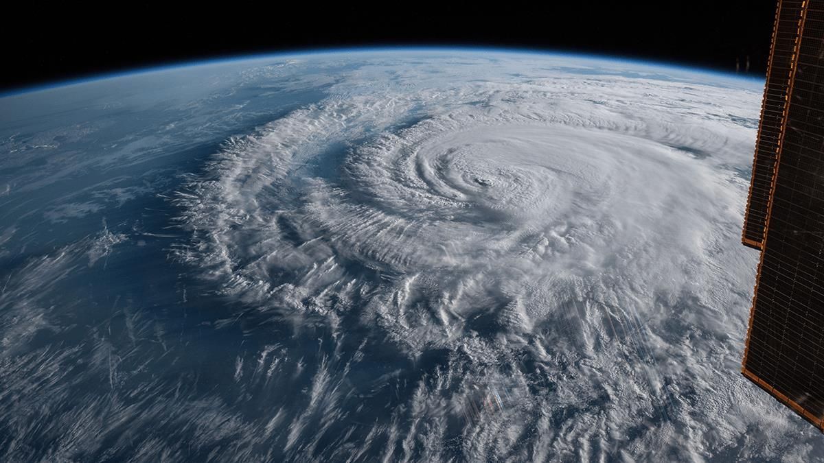
Hurricane Florence as a category 1storm near Wrightsville Beach, North Carolina.
Credit: NASA
Monitoring of Hurricanes
The National Hurricane Center (NHC) monitors, predicts, and forecasts all tropical cyclone activity in the Atlantic and Eastern Pacific basins around North America. They forecast all information regarding tropical cyclones including the track, intensity, size, and structure of the cyclones, as well as storm surges, rainfall, and tornadoes associated with them. Tracking and monitoring of cyclones are primarily done through the use of weather satellites but ships, buoys, and radars may sometimes be used as well. It is important to always look out for news, updates, and warnings regarding tropical cyclones during the hurricane season. It is extremely important to heed all the safety measures that are given to protect both you and your properties. Simply taking caution can go a long way in preventing severe damage.
But Do These Storms Pose Any Advantage?
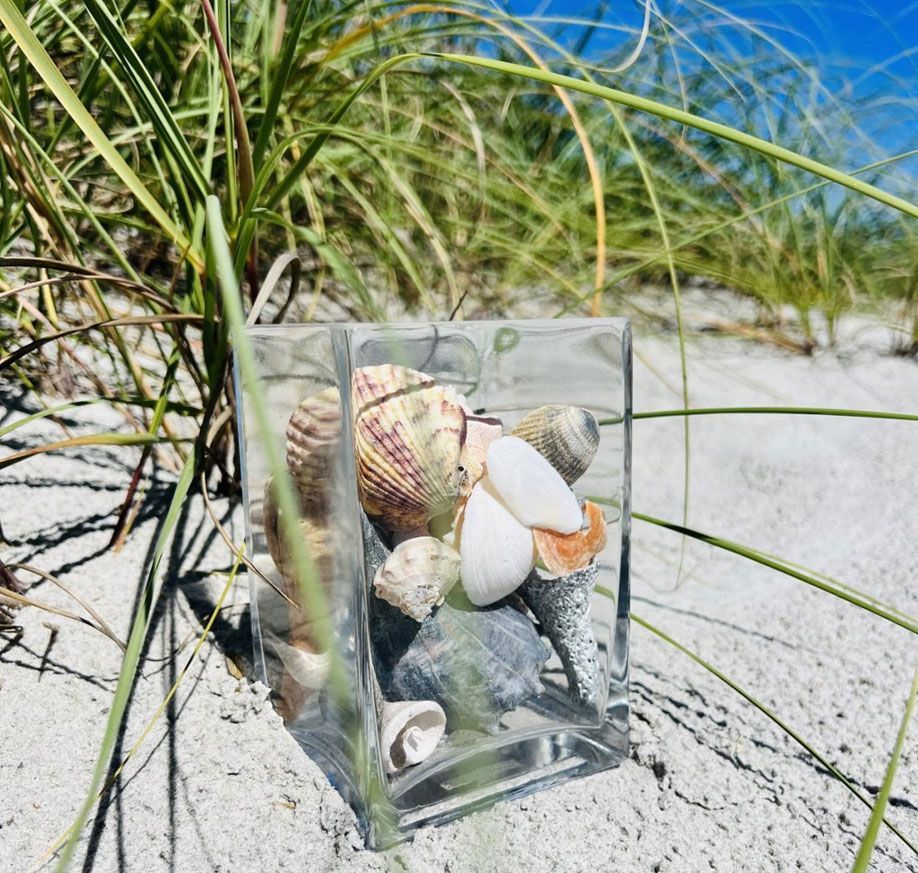
While storms and hurricanes can be devastating and annoying, they do serve important purposes in their own way. They help to regulate climate and stabilize the earth’s temperature by moving heat energy from the equator to the poles. They also help to flush out weeds and waste from lagoons and smaller waterbodies nearby. One exciting thing about these storms is that seashells and sea glass from the sea bed are resurfaced and deposited at the beaches. For this reason, you stand great chances of finding rare and beautiful sea shells and sea glasses if you go beachcombing after a storm. Who knows? You may even find an undiscovered treasure or artifact unearthed by the rollicking waves.
Hurricanes aren’t very friendly but the monitoring systems for Hurricanes these days and the prediction of their path help prevent severe damage, especially to the lives of people. If you are in North Carolina, either for a holiday or because you live here, we strongly recommend that you habitually look for updates from NHC, NASA, and the World Meteorological Organization. If you are up-to-date on the forecasts and you follow all the safety measures, you shouldn’t have much to be concerned about.